Achnancarranan
Image: Niall Colthart
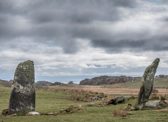
Three standing stones form a row at Achnancarranan, aligned northsouth. The middle stone has fallen and is now partly embedded into the ground. These stones are known locally as the ‘Witching Stones’.
Further information (external link):

Àirigh Ghuaidhre
Images:
Top, Steve Mithen
Below, Crown copyright, Historic Environment Scotland
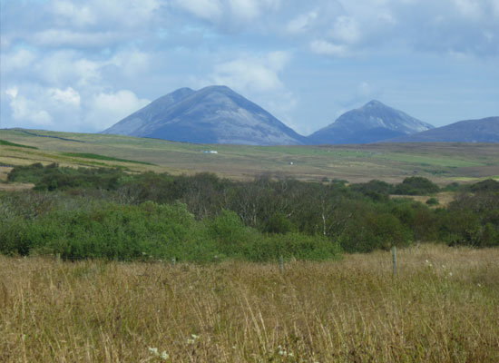
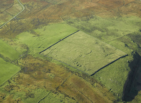
This is a deserted township consisting of nine longhouses, two subsidiary buildings, six limekilns and a string of interconnecting stock enclosures and boundaries, seen at distance from the west, above, and in an aerial view below. Amidst the 19th century buildings are traces of probable prehistoric structures. Nearby is the late Mesolithic site of Storakaig, dating to around 5800 years ago, marked by the small white polytunnel below the Paps of Jura. Just as at other key locations elsewhere on Islay, Àirigh Ghuaidhre was a favoured place for settlement throughout prehistoric and historic times.
Further information (external link and PDF brochures):
Download the brochure: EIMP supplementary report Airigh Ghuaidhre

Ballinaby
Image: Steve Mithen
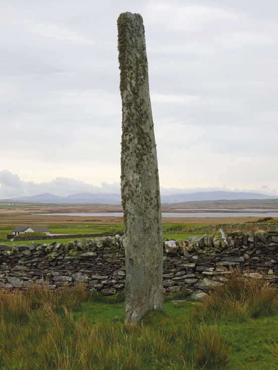
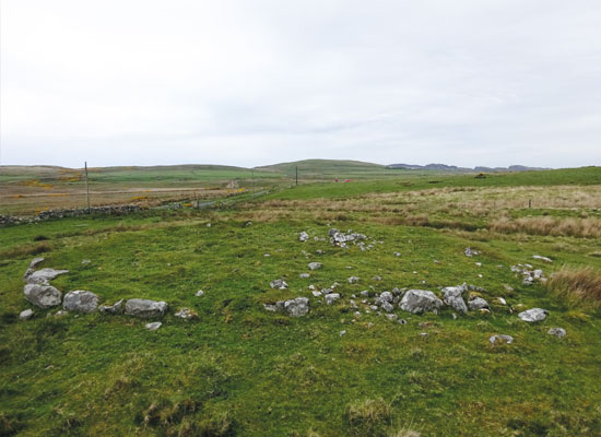
Islay has a large number of standing stones, likely dating to the Late Neolithic and Early Bronze Age, 4,000–3,000 years ago. The magnificent standing stone at Ballinaby is almost five meters tall. No one knows what these standing stones were used for: they might have been meeting places, territorial markers, religious centers or astronomical devices. A second standing stone at Ballinaby is located about 200m away, whilst the presence of a third was recorded in the mid-18th century, however there is no trace of it today.
Further information (external links):

Carnduncan
Image: Steve Mithen
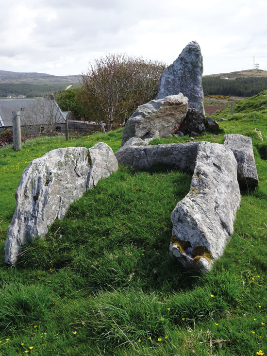
This is a Bronze Age burial cairn, most likely dating to between 3,500 and 2,800 years ago – it has never been excavated. The cairn is 17 meters in diameter with large boulders forming a kerb around its the perimeter. A burial chamber is likely to exist in the centre of the cairn, probably for whoever had been the leader of the Bronze Age community.
Further information (external link):

Cragabus
Image: Steve Mithen
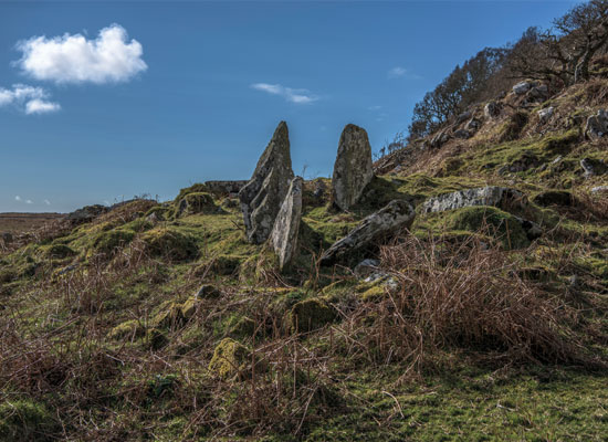
The chamber and part of the façade are all that remains of the Neolithic Chambered Cairn at Cragabus. When the site was excavated in 1901, a large number of human bones were found within the compartments. The burial chamber itself appears to have been divided into three compartments. In light of distinctive pottery found in the chamber, along with bones from an ox and sheep, the tomb appears to have also been re-used in the Bronze Age period.
Further information (external link):

Cnoc an Altair
Image: Nail Colthart
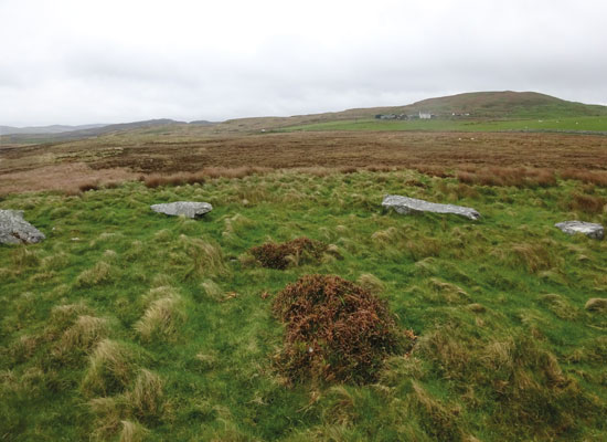
This is the remains of a Neolithic burial tomb, likely to be around 5,000 years old. It was built shortly after Neolithic farmers first settled on Islay, having originally arrived in Britain from continental Europe. For several hundred years they lived side-by-side with the Mesolithic hunter-gatherers. However, by 5,500 years ago, all signs of the Mesolithic had disappeared from the island. In their place were the first monuments on Islay: Neolithic Chambered Cairns used to bury the dead.
Further information (external link):

Cultoon
Image: Steve Mithen
This is the only stone circle present on Islay, and was constructed in the Bronze Age. It consists of three upright stones and twelve stone blocks lying flat on the ground, forming an ellipse 40m X 30m. Excavation in 1974 and 1975 suggested that the twelve stones had never been erected, and the site had been abandoned before the stone circle was completed.
Stone circles are found throughout Britain, the most famous being at Stonehenge, Avebury and Callinish. Their actual purpose is unknown, but they might have been meeting places for trade, ceremonial centres or for astronomical alignments.
Further information (external links):

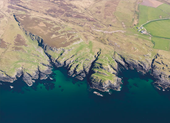
Dun Bheolain
Image: Crown copyright, Historic Environment Scotland
Iron Age and later forts were also built on the rocky coastline of Islay, their defences making use of headlands and narrow inlets. Dun Bheolain is the largest of these, protected on three sides by steep cliffs and with two stone walls blocking the approach from the landward side. Several platforms are evident inside the fort. Because of the fort’s highly exposed nature, it seems unlikely that these platforms had been used as houses.
Further information (external link):

Further information (external link):
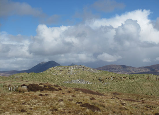
Dun Bhoraraig
Image: Steve Mithen
This is the only stone-built broch on Islay. Brochs were massive circular, stone towers with hollow walls, which probably functioned as the ‘castles’ of the Scottish Iron Age. The walls at Dun Bhoraraig are almost 5 metres thick, enclosing a central court measuring 13.5 metres in diameter. Although much of the stone has been removed, and the structure is largely buried by rubble, a narrow entrance passage is still evident adjacent to a guard chamber built into the wall itself. Chambers are evident elsewhere, also constructed into the walls of what must have been a commanding tower overlooking the Sound of Islay to the east, and the landscapes of Islay to the west.
Further information (external link):

Dun Guaidhre
Images:
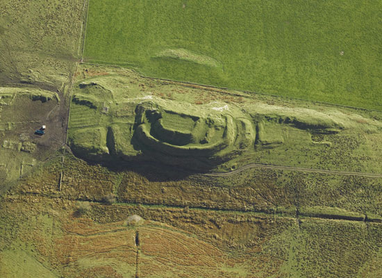
Top, Crown copyright, Historic Environment Scotland
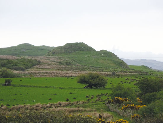
Below: Steve Mithen
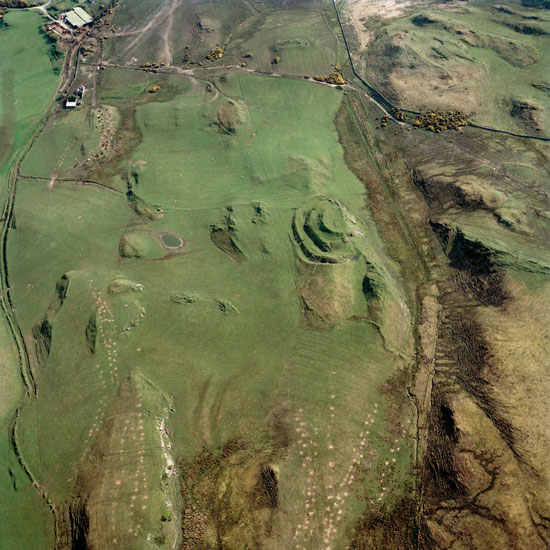
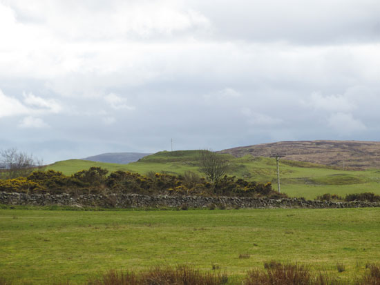
During the Iron Age, between 2,800 and 1,500 years ago, large fortified settlements were built on Islay, often on prominent ridges and hilltops. Constructed on the edge of a steep rock-face, close to the centre of Islay, Dun Guaidhre is one of the most striking. Dun Guaidhre’s defences consist of a massive stone wall built around the perimeter of the summit, and three surrounding ramparts, with entrances on the northern side.
Further information (external links):

Dun Nosebridge
Images:
Top: Crown copyright, Historic Environment Scotland
Below: Steve Mithen
The defences at Dun Nosebridge consist of a wall enclosing the summit and two outer ramparts, although these do not continue around the steep rocky slope on its south-east side. The turf-covered foundations of late 18th and 19th century buildings are visible nearby, associated with rig and furrow cultivation, and this extends into the interior of the fort.
Further information (external links):

Frachdale
Image: Steve Mithen
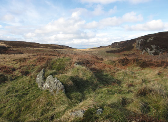
At Frachdale, four stones mark the edge of a Neolithic burial chamber and one further stone divides it into two compartments. Three massive stones lying in front of these are part of a collapsed façade which once marked the entrance to the tomb.
Further information (external link):

Giant’s Grave
– Slochd Measach
Image: Steve Mithen
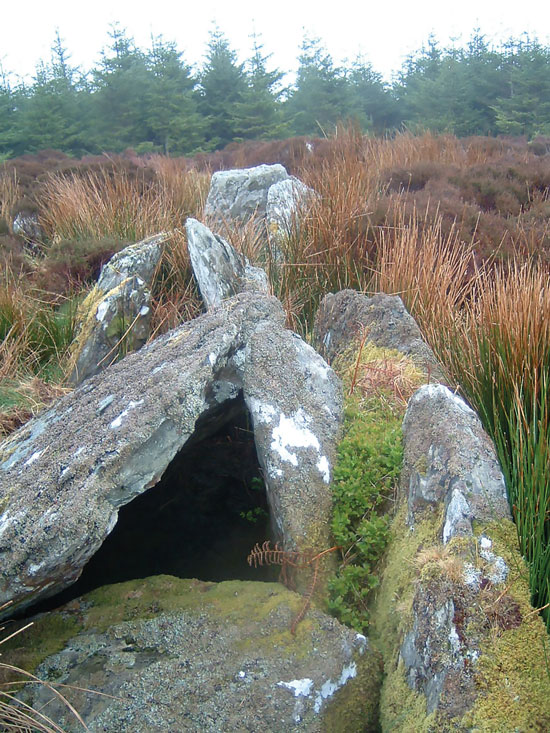
The Giant’s Grave Neolithic Chambered Cairn is currently undergoing excavation by the University of Reading in collaboration with Islay Heritage. This will expose its architecture and establish the date of construction. The Giant’s Grave appears to have been the largest Neolithic Chambered Cairn on Islay, with its burial chamber divided into four compartments and massive standing stones at its entrance.
Further information (external link and PDF brochure):

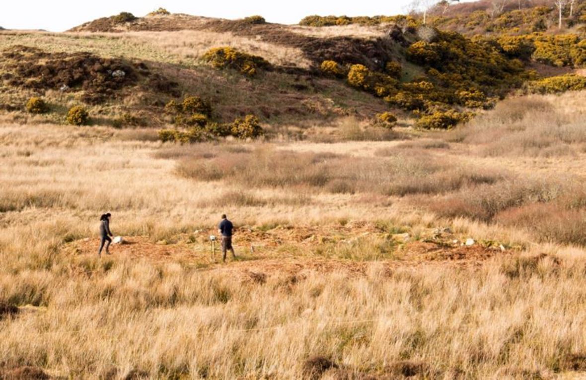
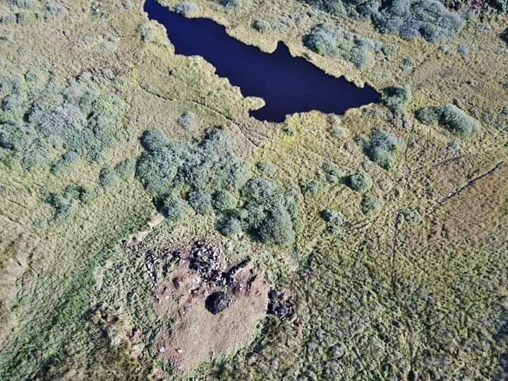
Loch nan Deala Crannog
Images:
Top: Steve Mithen
Below: Billy Stitchell
A small settlement was once located on an artificial islet, or a crannog, in the now mostly drained Loch nan Deala. Crannogs are artificial islets constructed from timber, stone, or a combination of materials. The earliest artificial stone islets we know of were constructed by the Early Neolithic settlers in the Western Isles almost 6,000 years ago. But these locations were re-used throughout the centuries. The crannog at Loch nan Deala was orginally believed to be the remains of Late Medieval or Post-Medieval buildings, but a 1996 survey consisting of radiocarbon dating of timber instead indicated the site was dated to the Mesolithic or Neolithic periods, around 7,000 to 5,000 years ago. Islay Heritage is currently conducting a project of surveys and excavations at the Loch nan Deala crannog to retrieve a more precise date for the islet settlement.
Further information (external link and PDF brochure):

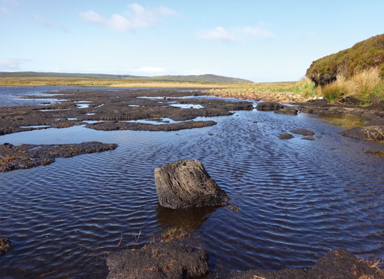
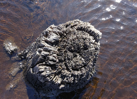
Machrie Loch
Images: Steve Mithen
These tree stumps in Machrie Loch provide vivid testimony to how the landscape of Islay has changed over time. They are the remains of a 7,800 year-old oak and hazel woodland that once covered the whole island, and flourished in what are now the vast treeless peatlands of Islay. The tree rings which survive in these ancient stumps will tell us about past climate change on Islay.

Port Ellen
Image: Steve Mithen
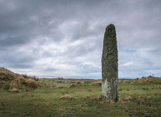
The Port Ellen standing stone is 4.30 meters high. Like the others on Islay, its surface is encrusted with lichen. A polished Neolithic stone axe, now in the National Museum of Antiquities of Scotland, was found close to the standing stone at the end of the 19th century.
Further information (external link):

Rubha Port an t-Seilich
Images: Steve Mithen
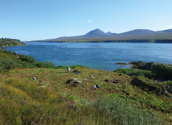
12,000 years ago the first known footsteps were made on Islay at Rubha Port an t-Seilich by ice age hunter-gatherers who camped here whilst making the first known exploration of the west coast of Scotland. After the Ice Age came to an end approximately 11,600 years ago, woodland spread across what had been tundra landscapes, and people settled on the islands and mainland. They continued to live as mobile hunter-gatherers, using Rubha Port an t-Seilich as a camping site during what we call the Mesolithic period.
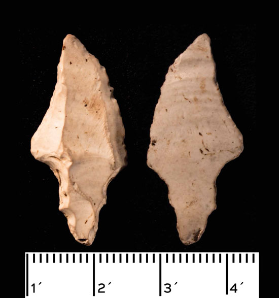
This flint point was made around 12,000 years – it is the oldest known artifact from Islay, and was found during excavations at Rubha Port an t-Seilich. The point was most likely an arrowhead used to hunt reindeer and red deer which grazed on herbs and shrubs growing on the tundra covering Islay.
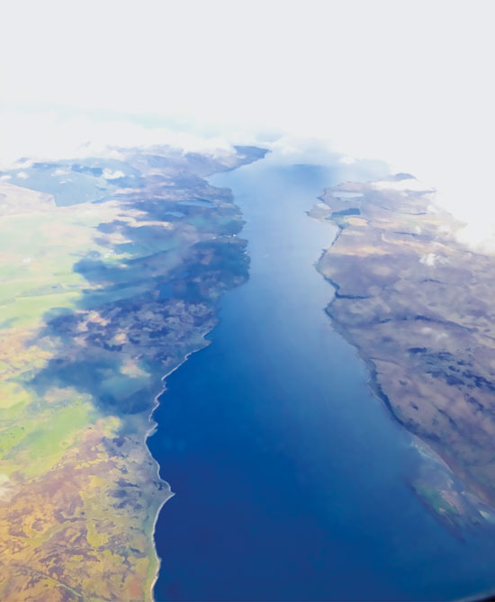
The aerial image to the left is looking northwards along the sound of Islay, with Islay to the left (west), and Jura to the right (east). The sound would have been a key route-way to the Hebridean islands. Rubha Port an t-Seilich is on the coast, adjacent to the modern-day ferry terminal of Askaig.
Further information (external links and PDF brochures):
Rubha Port an t-Seilich on Canmore
Download the brochure: EIMP brochure Storakaig and Rubha Port an t-Seilich


